Up to 6 Weeks Free Base Rent!*
*Min Term Req’d. Other costs & fees excl. Terms apply. Select Units. Offer may change.
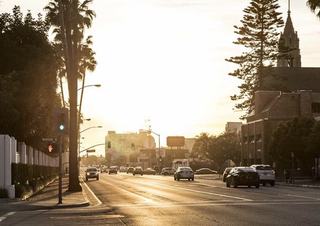
Driving is still the default for many residents that live in Culver City, where the commute is easier than a lot of LA because of its central location. Driving is very workable, especially for cross-town trips, but you’ll still want to plan around rush hour and learn where the public garages and residential permit zones are.
Key routes:
* Freeways: Offers quick access to the 10 (east–west) and 405 (north–south).
* Major surface streets: Venice, Washington, Jefferson, Culver, Sepulveda, La Cienega all cut through or border the city.
Distances & Driving Times
* Downtown Los Angeles is about 9 miles away, typically a 20–35 minute drive via the 10.
* Santa Monica sits roughly 7 miles west, usually 15–25 minutes by car.
* Beverly Hills is around 6 miles northeast, often 15–20 minutes depending on traffic.
* LAX is about 6 miles south, typically a 15–20 minute trip.
* Playa Vista is 3–5 miles away and generally 10–15 minutes by car.
* Venice Beach is roughly 5–6 miles southwest, usually 15–20 minutes to reach.
Traffic patterns:
* Morning congestion is common on the 10 and along Venice/Washington as commuters head east toward downtown or west toward Santa Monica.
* Intersections around the 405, Jefferson/La Cienega, and Sepulveda can be slow at rush hour.
* The city has been working on signal timing and mobility projects to ease congestion and improve safety as part of its broader mobility and “Complete Streets” planning.
Parking
Downtown Culver City has three public parking structures plus on-street parking. Structures are at Cardiff Ave, Watseka Ave, and Ince Blvd, with extended hours into late evening on weekends. In surrounding residential areas, some blocks use a permit system to prevent spillover parking. Residents can apply online for residential permits and manage renewals through the city’s Get-a-Permit portal.
For LA, Culver City is unusually well served by transit, especially if you live near the E Line or along one of the major bus corridors. If you’re near the E Line or a major Culver CityBus corridor, you can realistically do a lot of daily travel without a car—especially trips to downtown LA, USC, Santa Monica, LAX, and nearby neighborhoods.
Metro E Line (Light Rail)
The Metro E Line (formerly the Expo Line) is Culver City’s backbone for rail. Typical end-to-end train trips between downtown LA and Culver City are around 30 minutes in normal operations.
Culver CityBus
Culver CityBus is the city-operated bus system and fills in a lot of gaps:
Regional Buses
Metro and Santa Monica’s Big Blue Bus routes overlap with Culver City along Venice, Sepulveda, and Washington, giving additional options for getting to UCLA, Santa Monica, and other westside neighborhoods.
Culver City quietly has some of the westside’s best everyday biking, especially if you plug into the existing paths and the steadily improving on-street network.
The Ballona Creek Bike Path
For commuting, Ballona Creek is the closest thing the westside has to a “bike freeway”—fast, direct, low-stress, and surprisingly efficient during rush hour. For recreation, it’s one of the easiest ways to reach the beach on two wheels. And within Culver City, the growing network of lanes and traffic-calmed streets makes short everyday rides—like to the store, a park, or the train—surprisingly convenient.
The path begins at Syd Kronenthal Park in east Culver City and runs roughly seven miles west to the ocean, where it meets the Marvin Braude Coastal Bike Trail. Once you’re on the creek path, the ride is almost completely separated from traffic, which is why many locals treat it as both a reliable bike-commuting corridor and an easy recreational route for weekend rides. For commuting, the path is especially useful if you work in:
Riders can avoid major arterials entirely for large sections of the trip, making it one of the rare stress-free ways to cross the westside during rush hour. For recreation, Ballona Creek is equally popular because:
* It offers a long, uninterrupted flat ride to the water.
* You can link into the coastal trail and ride all the way to Santa Monica Pier or Redondo Beach.
* It has scenic overlooks near the wetlands and bird habitats close to the marina.
Other Routes
Other east–west routes like the Culver Boulevard Bike Path and Venice Boulevard bike lane offer solid connective tissue through the city, giving riders a mix of protected paths, buffered lanes, and quieter residential streets to choose from. These are typically favored by local commuters, students, and anyone biking to errands, cafés, gyms, or the E Line.
Walkability in Culver City varies by pocket, but the core areas score very high. If you live near downtown, the E Line, or VOX at Cumulus, you can comfortably walk to groceries, restaurants, and transit. Further out, you’ll still walk within your immediate neighborhood but likely drive or bike for bigger errands. o support this, the city adopted a Bicycle and Pedestrian Action Plan and is actively upgrading crosswalks, traffic calming, and sidewalk conditions as part of its long-term mobility vision. Most walkable areas include:
Outside the core, some stretches (especially near large commercial centers and around freeway ramps) feel more car-oriented, with wider roads and fewer shade trees—but you can usually find quieter residential streets running parallel.
VOX sits in one of the most connected pockets of Culver City thanks to its position at the crossroads of major transit and mobility options in Culver City. The E Line station at La Cienega/Jefferson is just steps away, giving you direct rail access to downtown LA, USC, and Santa Monica without transfers. Major corridors like La Cienega, Jefferson, Venice, and the 10 and 405 freeways put the rest of the westside within a quick drive, while frequent Culver CityBus routes provide simple, low-cost connections to LAX, West LA, and the beach.
The area is also walkable—Whole Foods and Cumulus retail are right downstairs—and biking is unusually convenient, with the Ballona Creek path offering a low-stress, direct ride to Marina del Rey and the ocean.