Your Culver City Connection
The Expo Line Bikeway is a paved, multi-use transit corridor that follows the Metro light rail right across the Westside of Los Angeles. While marketing maps often treat it as one continuous trail, the infrastructure actually changes based on which direction you pedal.
- Heading west from Jefferson / La Cienega toward Culver City and Santa Monica, it operates as a fully dedicated, car-free greenway.
- Heading east toward West Adams and Downtown LA, the off-street path ends, transitioning into on-street, painted bike lanes that share the road corridor with local traffic.
You can walk to this network from VOX in seconds. The access point is located just across the street from the apartment building and Whole Foods grocery, at the Jefferson / La Cienega intersection right beside the Metro station entrance. From here, you can choose a completely protected coastal cruise or a quick urban street ride.
What's the Expo Line Bikeway Route?
- Miles 0.0 – 5.0 (The Eastern Stretch): Starting at its eastern terminus near USC, Exposition Park, and Downtown LA, the route begins as 5 miles of on-street bike lanes heading west. This part operates as on-street, painted bike lanes.
- Mile 5.0 (The Mid-Point / Vox & Cumulus Area): The path reaches the La Cienega/Jefferson intersection right outside the Cumulus district, serving as the official transition point where it shifts from street lanes into a dedicated greenway.
- Miles 5.0 – 11.7 (The Western Stretch): From Vox heading west, the path opens up into roughly 6.7 miles of mostly off-street, protected bike path cutting directly through Palms, Cheviot Hills, and West LA. (Note: There are a couple of short on-street gaps to navigate in this stretch, specifically around the Culver City station and the Northvale segment near Overland Ave).
- Mile 11.7 – 12.0 (The Western Terminus): The path finishes its 12-mile run at 17th Street and Colorado Avenue in Santa Monica, dropping riders off right beside Santa Monica College and just blocks from the coast.
Local Everyday Routes from Jefferson / La Cinega
- Downtown Culver City Dinner (1.5 miles away): Follow the Expo Line Bikeway west for just a few minutes to drop straight into the heart of Downtown Culver City. This flat, highly protected cruise is perfect for grabbing dinner at the Culver Steps, hitting the Tuesday Farmer’s Market, or catching a movie without ever dealing with parking traffic.
- Arts District & Helms Bakery Loop (0.8 miles away): For a quick morning coffee or pastry run, ride west along Washington Blvd straight to the historic Helms Bakery District and the surrounding Culver City Arts District. It’s an easy, under-5-minute neighborhood pedal on low-speed streets.
- The Park to Playa Fitness Climb (2.5 miles away): If you want a solid workout, take the bike path west, turn south down Duquesne Ave, and cross Jefferson Blvd to enter Culver City Park. This park serves as your direct gateway to the Baldwin Hills Scenic Overlook and the continuous Park to Playa Trail system, offering stunning panoramic views of the entire LA basin for those willing to tackle the steep uphill climb.
- The Ballona Creek Straight-Shot (Variable): Accessed via the nearby ramp at Syd Kronenthal Park just a few blocks away, this entirely car-free greenway is the area's go-to loop for a fast, uninterrupted morning jog or cycling workout. Because it has zero street intersections or traffic lights, it's perfect for when you just want to put your headphones in and clear your head without stopping for 7 miles all the way to the marina.
- The West Adams Foodie Shortcut (1.2 miles away): Acclaimed dining Aspots like Alta Adams, Johnny’s Pastrami, and Tartine are just a flat, 7-minute bike ride away. Use the bike lanes along Exposition Blvd parallel to the Metro tracks, and then make a quick left turn northward up a quieter residential cross-street like Hauser Blvd or Chesapeake Ave to drop straight onto West Adams Blvd. Note that this route requires sharing the road with local traffic via bike lanes.
Mid-Range Excursions (3 to 6 Miles One Way)
- The Mar Vista Sunday Market Cruise (3.5 miles one way): Take the Expo Line Bikeway west and transition seamlessly onto the Venice Blvd parking-protected bike lanes to cruise straight into Mar Vista. It’s a flat, incredibly straightforward ride that drops you right at the bustling intersection of Venice and Grand View—perfect for checking out the famous Sunday Mar Vista Farmer's Market or local coffee shops.
- The Kenneth Hahn Park Loop (3.2 miles one way): Take the bike path west, turn south down Duquesne Ave, and cross Jefferson Blvd into Culver City Park to access the Park to Playa Trail. Follow the winding, scenic path up and across the ridge directly into Kenneth Hahn State Recreation Area. This route offers a great cardio workout and connects you to expansive grassy fields, a fishing lake, and incredible skyline views.
- The Marina del Rey Coastal Gateway (6.5 miles one way): Hop onto the bike path west for one mile, then drop onto the completely car-free Ballona Creek Bike Path at Syd Kronenthal Park. Take the creek path straight to where it meets the wetlands and marina channels. It’s an entirely uninterrupted, flat cruise that gets you right to the water's edge without dealing with a single traffic light.
- The USC & Exposition Park Run (5.0 miles one way): Head east from Vox along the Exposition Blvd bike lanes for a direct, flat route into the historic University Park neighborhood. This 5-mile stretch takes you straight to the USC Campus, the Natural History Museum, and the California Science Center, making it a great alternative to event-day traffic and stadium parking.
Longer Trips
- The Santa Monica Beach Cruise (11.5 miles one way): Jump directly onto the Expo Line Bikeway heading west for a long, flat, and mostly protected cruise straight to the coast. The dedicated path drops you off at 17th Street/Colorado Ave, leaving you just a few blocks from the Santa Monica Pier and the Marvin Braude Beach Trail for a completely car-free beach day.
- The South Bay Coastal Trek (15.0+ miles one way): Hop onto the bike path west for one mile, then transition seamlessly down the entirely car-free Ballona Creek Bike Path all the way to Playa Del Rey. Once you hit the coast, the path links directly into the Strand beach path, allowing you to cruise south through Manhattan Beach, Hermosa Beach, and Redondo Beach completely uninterrupted.
- The Playa Vista Tech Center Loop (7.2 miles one way): Take the bike path west for a mile, enter the Ballona Creek Bike Path at Syd Kronenthal Park, and head southwest toward the coast. Exit at the Centinela Ave or Campus Center Dr ramps to drop right into the heart of Playa Vista ("Silicon Beach"). It's a smooth, low-stress commuter route that bypasses all the standard cut-through traffic.
- The Redondo Beach Marina Metric (18.5 miles one way): Follow the Ballona Creek Bike Path all the way to its ocean terminus at Marina del Rey, then track the coastal Marvin Braude path south past LAX and through the South Bay beach cities. This flat, ocean-breeze-filled route takes you all the way down to the King Harbor Marina in Redondo Beach, making it a spectacular weekend endurance ride.
Modern Culver City Living at VOX
New luxury apartments at VOX are perfectly positioned near Culver City Whole Foods, where the Expo Line Bikeway and Ballona Creek trail meet the La Cienega/Jefferson station. Enjoy floor-to-ceiling windows and balcony views plus a luxe suite of resident amenities: scenic pool terrace, expansive fitness center, inspired coworking and more.
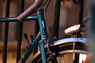
The building also features a dedicated, secure resident bike storage room. Contact us about move-in specials or to schedule a tour. You can ask the leasing team to show you the storage setup alongside the rest of the amenity spaces!